

words and photos by Sharon Bader and Lee Lau unless otherwise noted.
Gooseberry Mesa
Frog’s Hollow 25 Hour Race Course
Rainbow Rim Trail
Hike in the Grand Canyon
Thunder Mountain
Scenic Drive Through Utah – Zion – Bryce – Scenic Hwy 12
Virgin River Rim Trail
Rides in Grand Junction and Fruita
Flowing Park – Colorado
We drove by the Grand Canyon back in 2001 but didn’t stop cause we didn’t have time to do it justice. So this trip we made a point of spending a couple of days in the area. One day for riding, the other for hiking. Still we only got a taste. Guess we’ll have to go back for a few more days of actually hiking to really see the grandeur of the place.
We drove from Hur’kin to Kanab to restock and get more ice. Then we drove down Hwy 89 to Jacob Lake and Hwy 67 to the North Rim. The Rainbow Rim trail is accessed via Hwy 22 off Hwy 67. Those who are adventurous can take Hwy 22 from Fredonia to the Rainbow Rim area. We drove down the Aquarius Plateau and up the Kaibob Plateau and climbed towards the North Rim of the Grand Canyon. This view North shows the colourful rock formations of the Colorado Plateau including formations creating Bryce, Zion and other parks in Utah.

Rocks on Drugs
We drive to Locust Viewpoint of the Rainbow Rim trail and set up camp on the rim. There is a nice breeze off the rim to keep the bugs away. When the system came in the next day the winds were HOWLLING up these cliffs.

Getting some reading in.
View into the canyon at Sunset. We are not even CLOSE to the Colorado River here.

Sunset
Since this is a remote area there are no facilities so I have to create my cooking area.

Campsite
The views at sunset were spectacular and difficult to capture.

reading at sunset
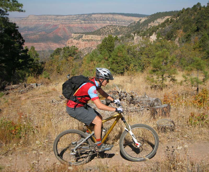
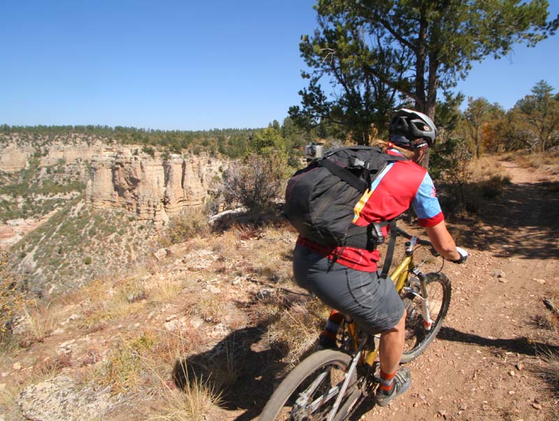
Tuesday we geared up for our ride on the Rainbow Rim Trail. The trail is 38miles long. It was recommended to ride the South leg one day and the North leg the second. We started out riding North towards Timp point. At each point of the trail there was a map to show you how far to go to the next point. Nice.
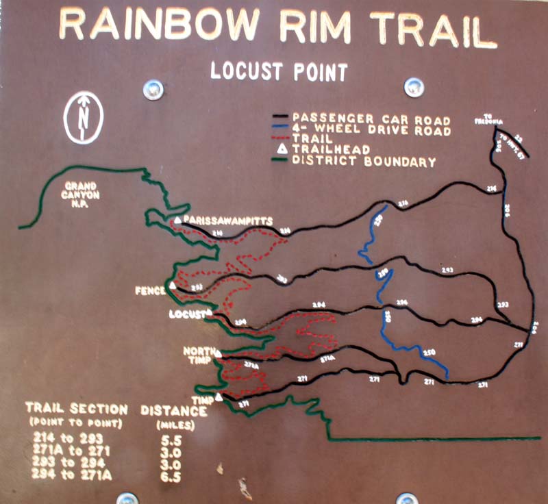
Good Maps.
View at the first point. Kinda hard to capture the scale of it all.

The Edge looking over the Edge!
The bikes like this.

The Element in its element.
I took 1.5 hours to get to Timp point…
Then we got back to Locusts point at 12:30… What to do the rest of the day?
So we did the other leg and completed the Rim trail in the same day.


Google Earth Image of the Rainbow Rim Trail overlooking the North Rim.

Not even CLOSE to the River!
Didn’t seem like that much climbing! Each point was at the same elevation – 2230m if I recall correctly. 1000m total climbing in 7:22 hours.

Since we were back with remaining daylight Lee felt the need to border our campsite with rocks.

Nice Border.
I’m working away in the Kitchen and Lee’s fiddling away with rocks.
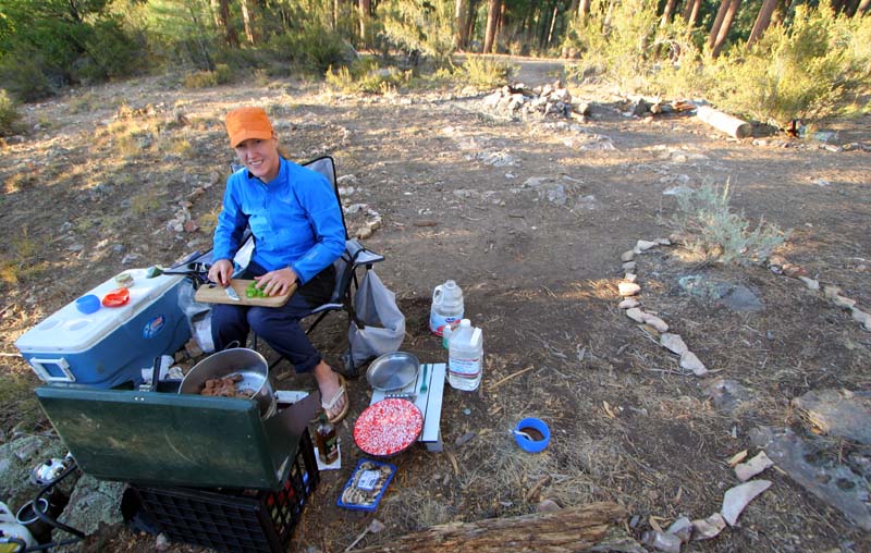
Cooking!
Lee always gets well fed on these trips!

By the look of the face maybe too well fed?
Ever faithful Volvo again doubling up as the drying rack.

such a great car!
Wednesday we are off to the North Rim of the Grand Canyon to go for our hike. yeah.

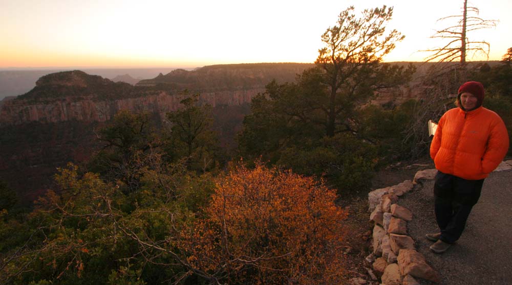
Fall colours were just hitting us!
The North Rim is not as popular as the South Rim but they still have a nice Visitors Center and Lodge.
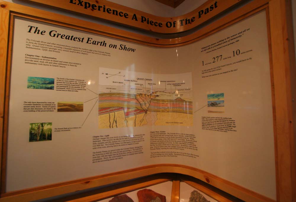
Info on the rock formations of the Grand Canyon.
We were going to listen to a Geology talk at the Lodge until the fire alarm went off so I guess it was time to start our hike! The trail starts at 8200feet (2500m). The river is at 2400feet. The South Rim elevation is 6800feet. Info sign telling people distances, warning them not to go further then they are able to, letting them know how many people have died trying to do both rims in one day. Interestingly enough we met three runners that day, two ran from the South Rim that morning and were heading back, a third was ONLY doing the rim from North to South. Apparently its a very popular thing amongst adventure runners to do. We were NO WHERE NEAR that ambitious. We hiked down 2000feet, in two hours then came back. That was enough for this trip.

North Rim started out cold!
We head down to the Coconino lookout .75miles and 500feet below the rim. The Roaring Springs Canyon is visible from here.

we continue down?
We head down the trail that is shared with Mules so its pretty loose and dusty. The rocks on the side make a much better hiking surface!

hikin’ the skinnies!
We head down further with the Coconino formation above us, we are now entering the Hermit formation.

getting warmer!
The Supai Tunnel is 1.8 miles from the Rim at an elevation of 6800feet. The mules don’t usually go beyond this point. We are now entering the Red Wall Formation.

nice lunch spot.
Most of the elevation is lost in the steep Red Wall formation. See the trail below in the Canyon?

great trail work!
More Red Wall.

nice rock work!
The Red Wall bridge 3 miles from the Rim.

Now THAT’S some bench cut!

totally ridable.

Don’t fall!
Lee found a friend at Lunch!

He probably spat on it…
That night we went to the Lodge to get some sunset shots. Below is a sign describing the view in the next photo.

Not bad!

It was getting chili with this system moving in.
But I was ok in my Persimmon!
brrrr
Sunset with the moon over Roaring Springs Canyon.

GPS track of our hike. The spur up the rim was an anomaly. We didn’t get even CLOSE to the river!

Rainbow Rim Trail Ride:
Rainbow Rim Trail, Grand Canyon – Arizona from Lee Lau on Vimeo.